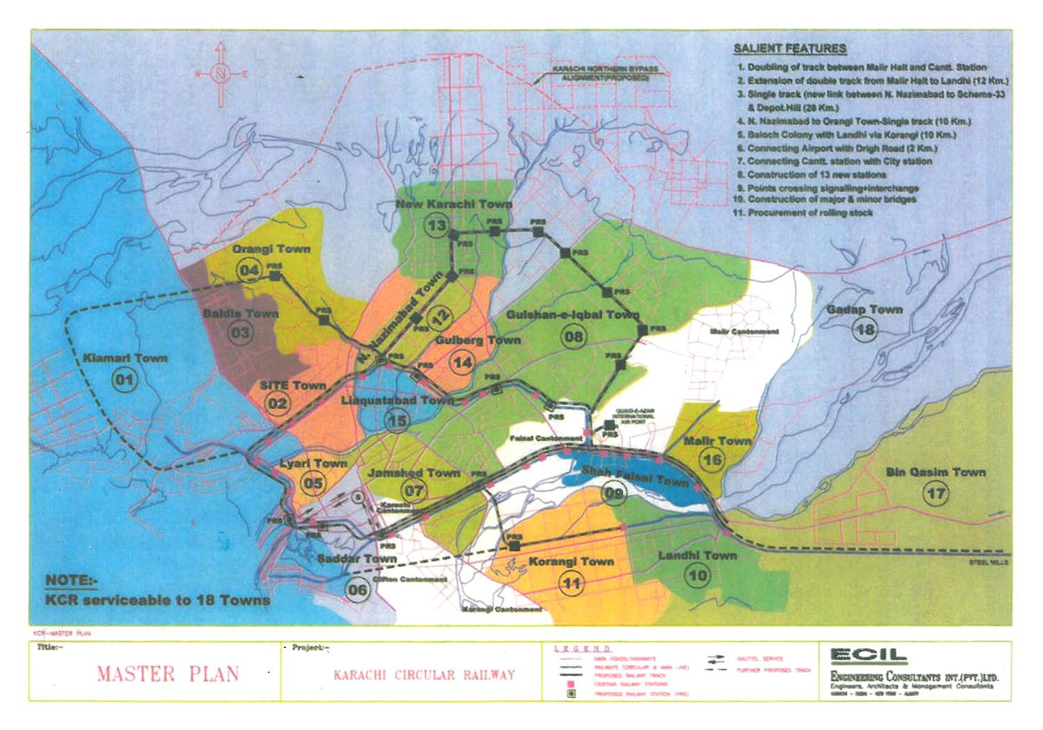
KCR Master Plan Map
KCR Master Plan Map, created as part of Karachi’s urban transport redevelopment, visually represents the proposed upgrades and expansions to the Karachi Circular Railway (KCR) system. The map outlines critical infrastructure changes including the doubling of track between Malir Halt and Cantt Station, as well as an extension of double track up to Landhi (12 km). It also features planned single-track routes such as the link between North Nazimabad and Scheme-33 via Depot Hill (28 km), and from North Nazimabad to Orangi Town (10 km). Additional connections include Baloch Colony to Landhi via Korangi (10 km), and the Airport to Righi Road (2 km). The project includes a direct connection between Cantt Station and City Station, construction of 13 new stations, installation of point crossings and signal interchanges, as well as the building of major and minor bridges. The procurement of new rolling stock is also part of the plan. This map is an essential resource for understanding the future of Karachi’s rail-based public transit. For HD quality versions, please contact us via WhatsApp—no need to search elsewhere.